The Byline Photo
A resized byline portrait is ready for publication. Review the file itself—not only the visible pixels—to determine whether it discloses a sensitive location.
Objective
By completing this module, you will be able to:
- locate machine-readable location metadata in an image; and
- explain why resizing an image is not the same as removing metadata.
Before you begin
Open The Byline Photo station and download the image. See Image metadata for tool guidance.
Concepts
Image files can contain EXIF, IPTC, and XMP metadata in addition to pixels. Metadata may record camera details, timestamps, captions, creators, or GPS coordinates. A visual resize can leave these records unchanged.
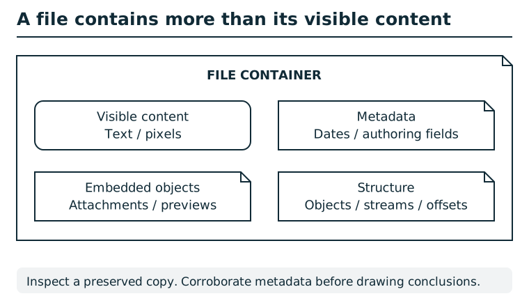
A file container can hold visible text or pixels, metadata, embedded objects, and structural information. A rendered view exposes only part of that content. Compare appropriate views of a preserved copy and record where each observation came from. Metadata may be stale or edited; corroborate it before attributing an action or identity.
Suggested tools
- Metadata viewer:
exiftool byline-photo.jpglists several metadata families; a graphical properties or metadata panel is an alternative.
Tool practice
Rehearse the worked tool exercise before using challenge data.
Run the full metadata listing before filtering for GPS. Record latitude, longitude, and hemisphere; use the numeric-output command if DMS conversion is unfamiliar. A filesystem Properties panel may show only size and modification date, not embedded GPS fields.
Investigation
Observe
Compare what the portrait visibly shows with the descriptive, time, and location fields reported by your metadata tool. Record the field names as well as values.
Form a hypothesis
Which metadata could identify where the photograph was made? Would that detail still be present if a publisher only changed the image dimensions?
Test carefully
Find the coordinate pair in the metadata and submit it in the order requested by the station. Decimal degrees and common degrees/minutes/seconds notation are acceptable; keep the north/south and east/west signs or labels intact.
Progressive hints
Hint 1
Look for metadata groups concerned with geographic position, not the caption.
Hint 2
In exiftool output, search for fields whose names begin with GPS.
Hint 3
Submit the latitude and longitude together, preserving their hemispheres or equivalent positive/negative signs.
Troubleshooting and reset
If the tool reports only basic filesystem properties, use a metadata-aware viewer. If a coordinate is rejected, check its order and hemisphere signs. A fresh browser session starts new progress; do not close the audit merely to retry this station.